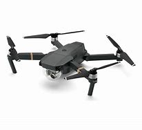
 MAPPING With the high quality imaging provided by the latest generation of drone technology, we turn the informaiton into a digital map that can be provided in a 2D or 3D perspective. Aerial images can proved a complete overall view of large properties, or close in perspectives of items of interest that are not easily obtained while standing on the ground.
VISUAL INSPECTIONS With drone imaging, you can get up close and personal with areas of structures that would be difficult to otherwise visualize for inspection.
Cirrus Digital can provide you with high quality images of your property for mapping, plus we can provide raw or produced video.
To find out more give us a call Toll Free at 866-588-6946 or complete the form below and one of our team members will get back to you shortly.
